
Reading Bukhara: Brick, Water and Power in a Changing City
A historical guide to the Samanid mausoleum, the Ark, Poi-Kalyan, covered markets and Lyabi-Hauz—and the different centuries that survive beside one another.
The Kalyan minaret and the great mosque beside it look like a single composition. They are not a single moment. The tower belongs to the twelfth century; the mosque that now helps frame it belongs to a much later rebuilding. That difference is a useful starting point for Bukhara. Its celebrated skyline is not a medieval photograph preserved in brick. It is a city in which successive rulers, religious institutions, traders and restorers have kept rearranging the relationship between old places and new uses.
A historical visit becomes more rewarding when the question changes from ‘How old is this?’ to ‘What survived here, and what changed around it?’ Bukhara offers unusually good opportunities to ask. The UNESCO description of the historic centre emphasizes the townscape, not simply a handful of exceptional monuments. Much of its recognizable urban organization belongs to the sixteenth century and after, although several much older buildings remain. The spaces between the landmarks—the route through a bazaar, the edge of a pool, the transition from street to courtyard—are part of the evidence.
This guide follows five kinds of place: a dynastic tomb, a citadel, a congregational complex, a covered market and a reservoir square. Together they reveal different ways a city organized authority, worship, exchange and daily movement. The route is a way of reading buildings, not a claim that all interiors are open or that the entire city can be understood in one walk.
A small tomb with a large history
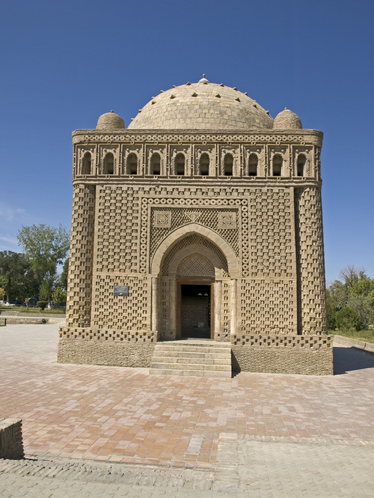
The Samanid mausoleum makes a strong beginning because its material is so legible. Instead of treating brick merely as something to hide under ornament, its builders turned the arrangement of bricks into ornament itself. A square mass, corner supports, openings and a dome give a visitor a compact structure to examine from several directions. The changing patterns matter more than the pursuit of one ideal photograph.
IRCICA’s architectural inventory places the mausoleum in the first half of the tenth century and identifies it with Ismail Samani’s burial. It also records a much more recent history: major study and restoration in 1937–39, followed by the transformation of the surrounding cemetery into a park during the Soviet period. The present setting is therefore not the original funerary landscape. A largely surviving building and a transformed environment can coexist.
Its dynastic association opens a window onto Bukhara’s Samanid period. As historian C. E. Bosworth explains in Encyclopaedia Iranica, the city became an administrative capital and a centre of Arabic learning and the development of New Persian literature. Court patronage helped make a city’s prestige intellectual as well as military. Bukhara’s importance cannot be reduced to caravans passing through it: people also came to obtain support, study, teach and participate in institutions rooted there.
The tomb should not, however, be made to stand for an entire lost capital. One celebrated survivor cannot show the full range of ordinary housing, work or social inequality. Its very survival makes it exceptional. Look closely at the construction, then keep that distinction between monument and representative sample in mind at the next stop.

The Ark: government above the street
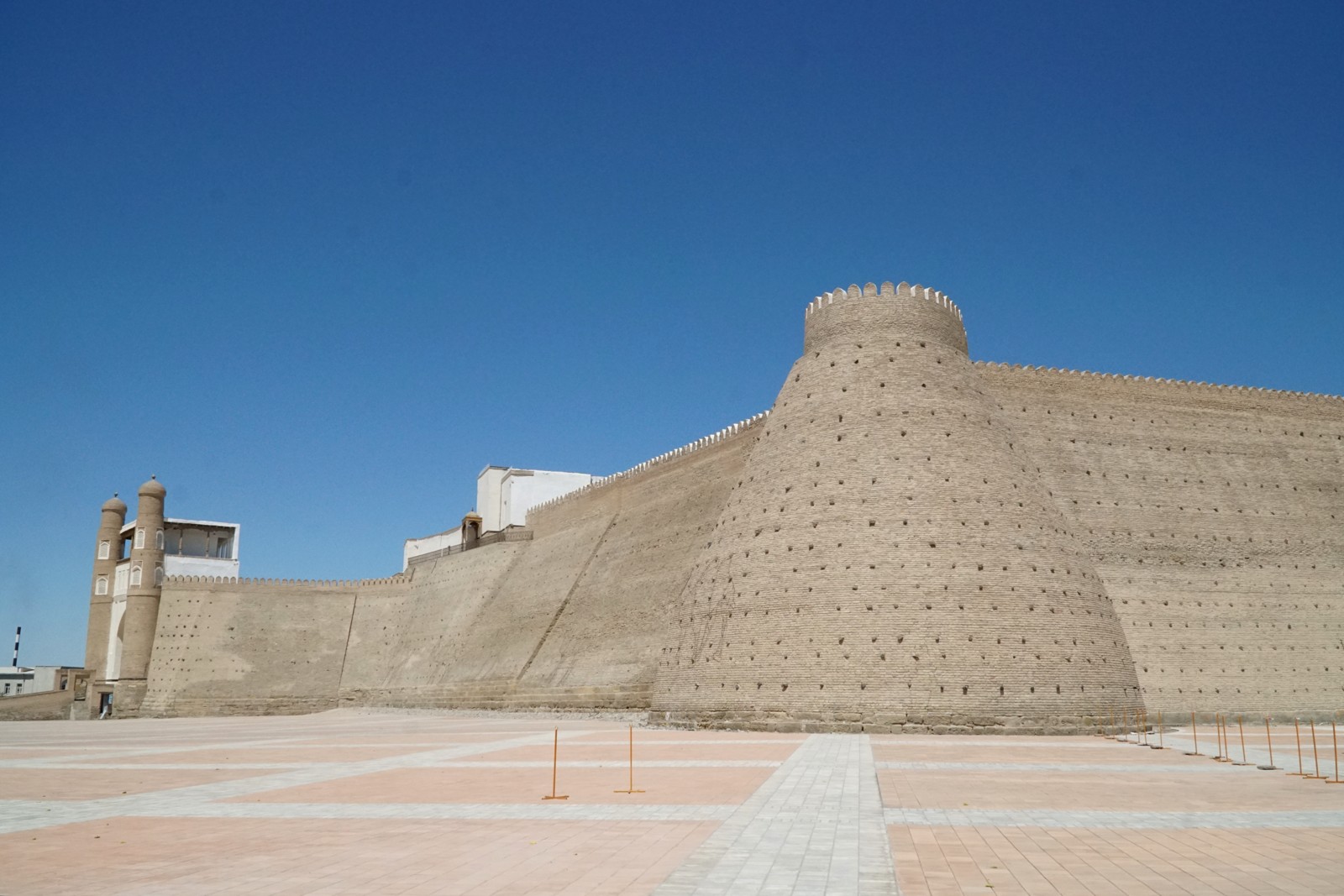
The Ark’s raised mass makes a different argument about space. Here, the relationship to the surrounding city is hierarchical: a strong enclosure, an elevated position and a controlled entrance distinguish the ruler’s domain from the streets outside. The visible walls are not proof that every part belongs to the same ancient foundation. According to the Bukhara museum’s account, the complex experienced repeated destruction and reconstruction, acquired much of its later form under the Shaybanids, and contains surviving structures from subsequent dynasties.
The museum identifies the entrance on the west as nineteenth-century and describes audience and throne spaces, a mosque, administrative courtyards, workshops, stores and residences. Until 1920 this was a seat of the rulers of Bukhara. Seen in that light, a palace was not simply a house with expensive decoration. It was an apparatus for receiving people, regulating access, keeping valuables and supplying a governing household.
Inside, when the relevant exhibitions are accessible, seek objects as well as rooms. The museum lists historical, numismatic and epigraphic collections. Coins and inscriptions can complicate the impression made by imposing walls: they offer dates, names and claims that architecture alone cannot supply. The distinction is useful even when an exhibit is closed. A building’s appearance, an archaeological layer and a ruler’s inscription answer different questions.
The archaeological account in Encyclopaedia Iranica places Bukhara’s earlier settlement in a relationship between citadel and town, followed by changing walls, streets and quarters. It also records the destruction of 1220 and subsequent rebuilding. The urban past is not one unbroken accumulation of prosperity. Rupture, abandoned structures and the redistribution of political power are part of the story beneath the modern visitor route.

At Poi-Kalyan, separate the tower from its neighbours
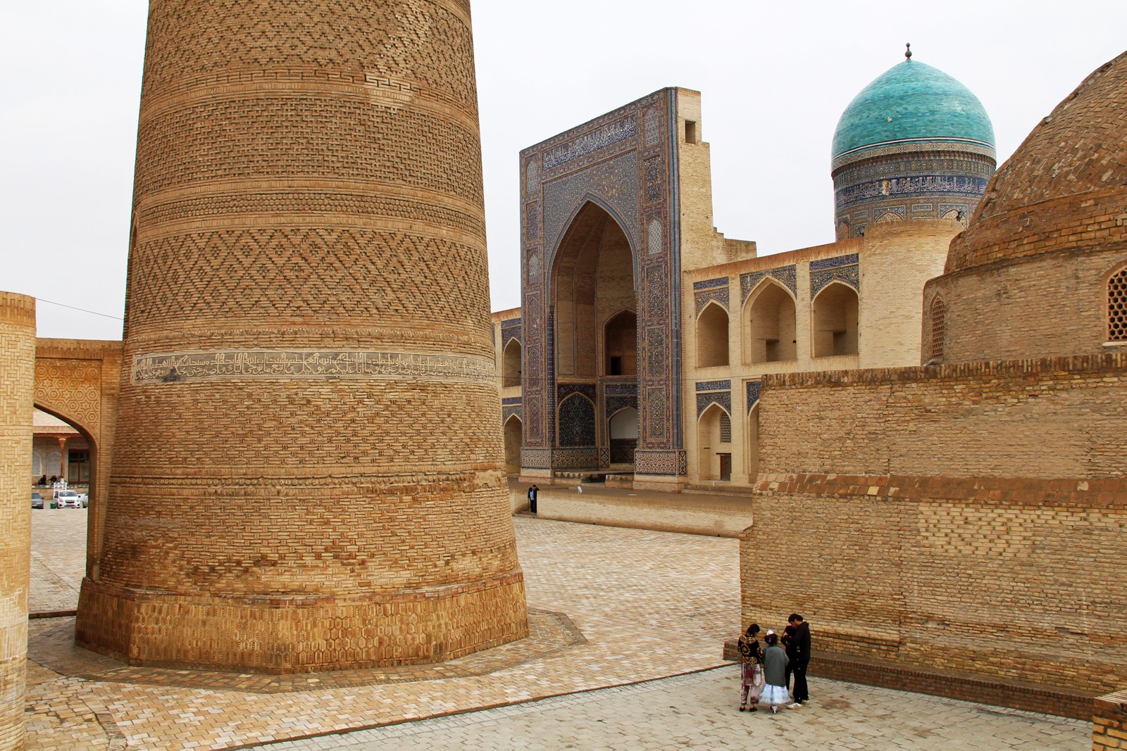
The Kalyan minaret rewards looking upward slowly. Its tapering shaft is articulated by bands of brick pattern rather than one continuous blank surface. The MIT architectural collection describes the baked-brick construction, the upper arcade and the sequence of ornament. These are features a visitor can look for without accepting every dramatic story later attached to the tower.
Chronology changes the view. The Getty architectural record dates the minaret to 1127 and associates its patronage with Arslan Khan. The national tourism description distinguishes that earlier monument from the sixteenth-century mosque and Mir-i-Arab madrasa that helped establish the later ensemble. The square is therefore evidence of selective continuity: a durable landmark could be incorporated into a new expression of religious and political authority.
A mosque and a madrasa were not interchangeable components of a picturesque scene. Congregational worship, teaching, residence and patronage brought different groups into these spaces. Their proximity helped concentrate activity; their entrances and courtyards also separated it. Look at how the portals face and frame each other, and how a person moving through the open space encounters one institution before another.
The Mongol conquest should likewise be kept distinct from the story of every surviving building. Michael Hope’s research summary on Bukhara under Mongol rule stresses recovery, renewed patronage and later disruptions within the Mongol world. A simple narrative of one destruction followed by timeless survival misses those changes. Nor does the survival of a tower establish the truth of a later anecdote about why a conqueror spared it.

Trade had an architecture
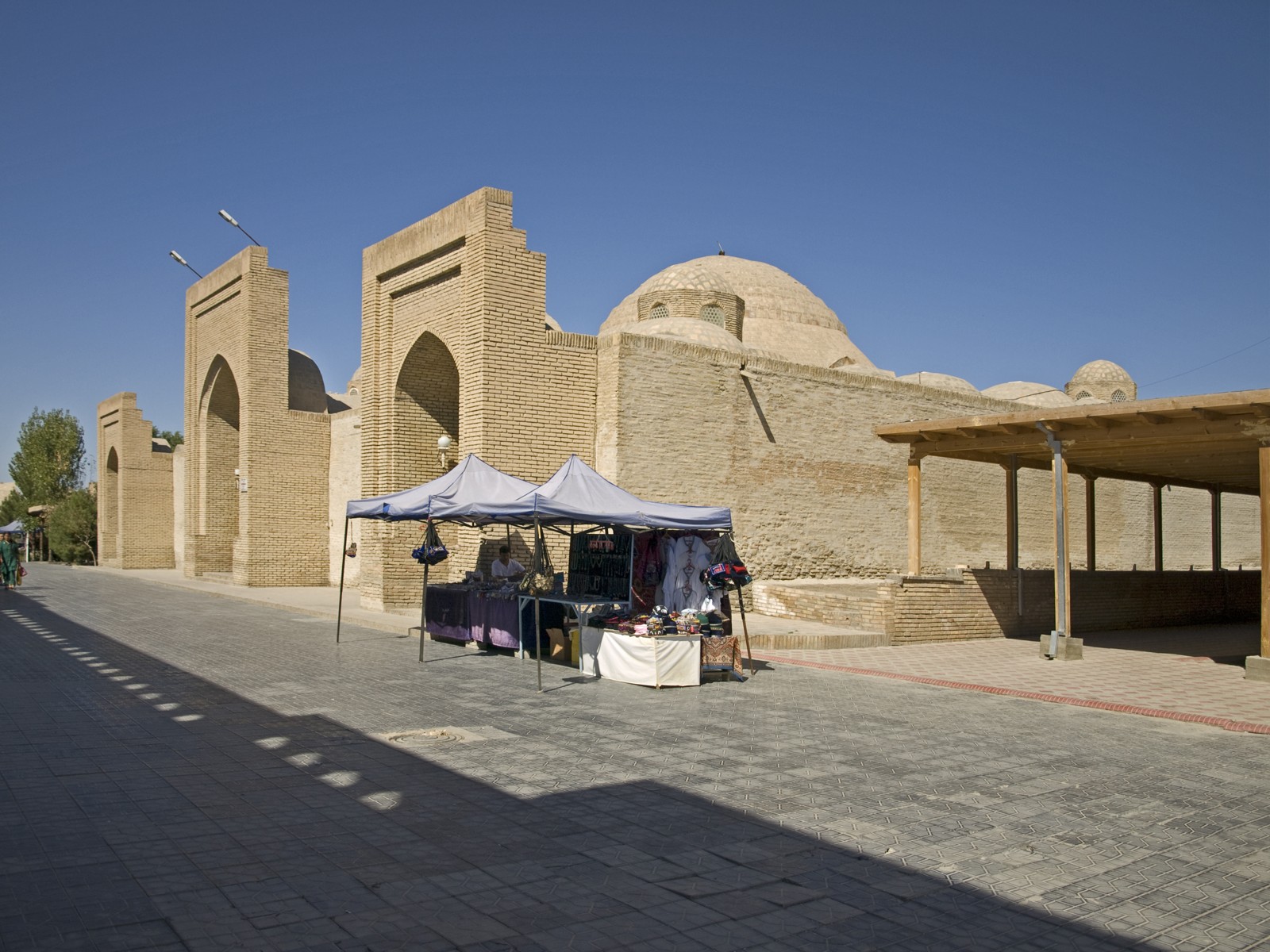
Between the great institutional complexes, covered trading spaces make the practical organization of commerce easier to see. A market was not only a meeting of distant routes. It needed places to display goods, shelter people and direct movement. At the Tim Abdullah Khan, the transition from outside light to an enclosed interior makes those requirements tangible.
The national tourism account places this market in the sixteenth century and distinguishes its enclosed form and western entrance from other bazaars. Light enters through openings above. Rather than assuming that the merchandise sold today reproduces the historical trade exactly, examine the more durable infrastructure: the roof, entrances, internal divisions and relationship to the adjoining street.
‘Silk Road’ is a useful geographical invitation, but a poor substitute for this closer inspection. The label can make a city appear to exist primarily for strangers on a journey. Bukhara’s markets also served inhabitants, craftspeople and institutions that needed regular supplies. A covered passage connects local routines to wider commerce without telling us that every transaction was international.

By the water at Lyabi-Hauz
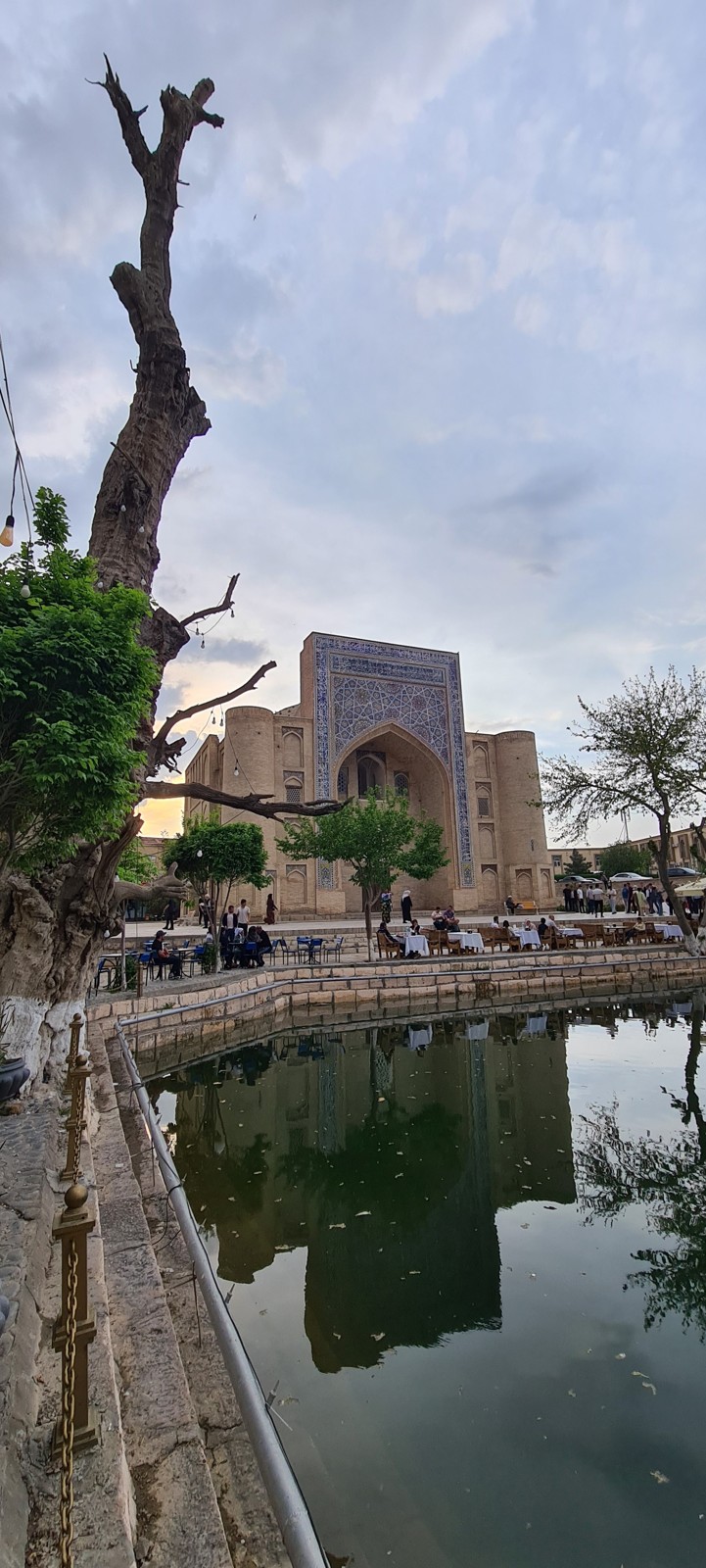
The Lyabi-Hauz ensemble brings another element into the route: a reservoir framed by religious and educational buildings. The Kukeldash madrasa, the Nadir Divan-begi madrasa and the khanqah give the square several institutional faces. A khanqah was associated with Sufi religious life; it should not be casually relabelled another school simply because its monumental facade resembles one.
Read the pool as part of the space, not as decoration added for a photograph. Water, shade, gathering and movement can organize a square as effectively as an isolated monument. The current tourist setting is another layer, not a reliable reconstruction of one particular century. The practical exercise is to compare the uses expressed by the different thresholds: what brought someone to the square, and where could they go from it?

A city is more than its monumental centre
Bukhara’s history also resists a single religious or linguistic label. Michael Zand’s study of Bukharan Jews explains that the term refers to a wider Central Asian Jewish population, historically associated with a Jewish variety of Tajik, rather than only residents of Bukhara. That distinction matters when reading the city’s neighbourhoods: a familiar place-name can conceal a much larger network of communities.
Do not turn residential streets or places of worship into exhibits that residents have implicitly agreed to provide. Ask before photographing people or entering non-public spaces. A historical guide can point toward lives absent from monumental accounts without inventing access to them, or treating current inhabitants as illustrations of the past.
Conservation is another visible part of the history, not an interruption to it. UNESCO’s 2025 World Heritage Committee decision requested further review of major projects, addressed concerns about new development and called for revised documentation on works affecting several monuments. The decision makes clear that an old-looking surface is not, by itself, a sufficient measure of successful preservation. Urban context and the consequences of reconstruction matter too.
The UNESCO project connecting the Rashid madrasa with Shashmaqom music offers a complementary perspective. Its published account joins conservation of a building to the transmission of a musical tradition. The account describes a project and its phases; it is not confirmation that a particular performance or exhibition will be available on the day of a visit.
Plan around access, not an assumed checklist
Check individual monuments and museums shortly before visiting. This guide was researched on 27 October 2026, but it does not quote a current ticket price or guarantee opening hours. The museum’s online visitor-information page contains undated and overlapping hours; those details are not reliable enough here to present as a current timetable. Confirm entrance arrangements, closures and any photography rules directly with the venue.
Choose a smaller number of interiors rather than assuming every building is accessible. At religious sites, follow posted guidance and local staff instructions. Visitors who need step-free access should verify the particular entrance and interior route rather than relying on the accessibility of the surrounding square. Allow time to compare buildings from the outside if admission is restricted.
The strongest route through Bukhara is not necessarily the one with the most stops. At each, distinguish a surviving structure from its reconstructed setting, a date from an anecdote, and a current use from a former one. The minaret beside its later mosque provides the model: two neighbouring buildings can tell a more precise story when they are not forced into the same century.