
Angkor’s Water City and the Long Transformation of a Khmer Capital
Reservoirs, canals, and household landscapes reveal how Angkor grew, weathered climatic stress, and changed over centuries rather than vanishing in a single catastrophe.
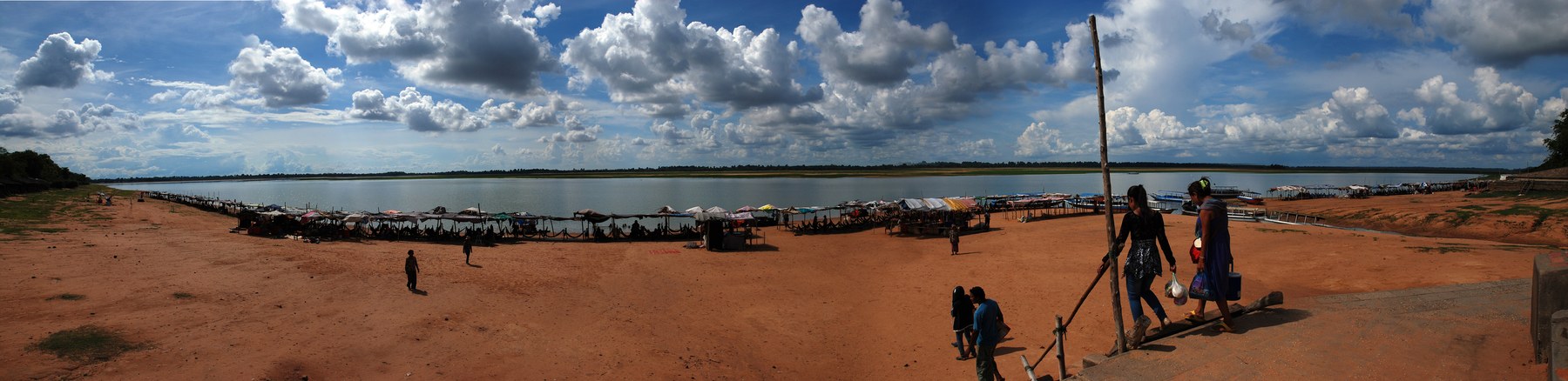
The West Baray is too large to take in as a piece of temple decoration. Its long banks hold a reservoir roughly eight kilometres from end to end. Across the water, the opposite shore can look like the edge of a natural lake. Yet this was a constructed landscape, assembled by people whose labor also shaped channels, embankments, fields, ponds, and the great stone sanctuaries of Angkor.
For centuries, the Khmer capital developed between the uplands to the north and the Tonle Sap lake to the south. Water helped make that urban world possible. It also bound distant parts of the landscape together in ways that could become difficult to manage. The story revealed by archaeology is therefore larger than the familiar image of a magnificent city suddenly swallowed by jungle: it is a history of growth, maintenance, environmental stress, and uneven transformation. UNESCO’s description of Angkor
A city beyond the stone temples
The most enduring buildings at Angkor were never the whole city. Houses built mainly from perishable materials have left much fainter traces than temple towers. To recover their setting, archaeologists study occupation mounds, depressions, pottery, paths, and the arrangement of earthworks. Research inside Angkor Wat’s enclosure has identified evidence of residential activity in a space a modern visitor might imagine as exclusively ceremonial. People lived and worked around the monuments; the temples were embedded in inhabited neighborhoods. research on Angkor Wat’s inhabited enclosure
Mapping changed the scale of this picture. The Greater Angkor Project combined field survey with remote sensing to trace a sprawling landscape beyond the celebrated ruins. Its 2007 archaeological map covered nearly 3,000 square kilometres. That number describes a survey area, not a continuous mass of streets or buildings. Within it lay an extensive, low-density settlement complex whose components included agricultural spaces as well as more closely occupied centers. The distinction matters whenever Angkor is compared with a compact walled city elsewhere. the Greater Angkor Project’s 2007 map
Laser scanning added another layer. In the survey reported in 2013, lidar recorded subtle changes in ground level beneath vegetation, exposing patterns difficult to follow from the ground. Planned grids and earthworks placed the temples within organized urban surroundings. These discoveries did not conjure a city from nothing: they refined decades of Cambodian and international archaeological work. They also shifted attention from what survives above ground to the surfaces that generations of inhabitants had reshaped. the 2013 lidar study
A later demographic study estimated that the Greater Angkor Region may have held about 700,000 to 900,000 people at its thirteenth-century peak. Such figures depend on assumptions about occupied areas, house plots, and household size. They are estimates of a region changing through time, rather than a medieval census or a count of people living inside Angkor Thom’s walls. Even with that caution, the research makes clear why feeding and supplying Angkor required attention to an entire landscape. a 2021 population model
Collecting the monsoon
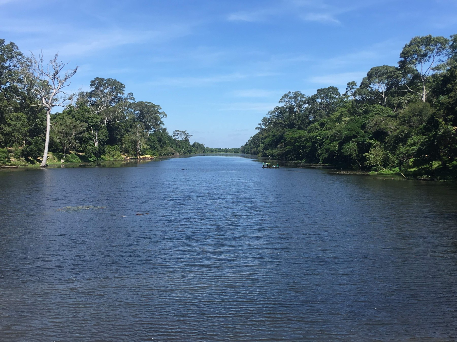
Angkor’s engineers worked with a powerful seasonal rhythm. They needed to handle abundant water during the rains while retaining and distributing supplies through drier periods. The system documented by Roland Fletcher and colleagues linked channels, reservoirs, embankments, and other features across the plain. Its functions included moving water around the urban core and passing it toward lower areas. Water management meant drainage and flood control as well as storage; simply imagining a collection of irrigation lakes misses much of the design. Fletcher and colleagues’ water-network study
The large barays were the most conspicuous elements, but they were only part of the arrangement. A reservoir was useful because water could enter it, remain available, and leave along a workable route. Banks that carried roads or divided spaces could also shape flows. The result developed through successive additions and alterations rather than as one finished blueprint. A new project entered a landscape already occupied by older channels, settlements, and fields. Engineering decisions therefore accumulated consequences beyond the reign in which they were made.
That long development complicates any picture of an omnipotent king simply switching the entire system on and off. Research on community temples and state-sponsored infrastructure distinguishes different scales of water management. Local settlements organized around temples could maintain their own arrangements while larger royal projects changed the conditions in which they operated. The relationship between community-level and state-level systems also changed over time. Archaeology allows historians to investigate that relationship without assuming that every pond was a royal command or every field part of an identical production regime. research on community and state water management
The physical evidence thus points toward coordination, but not toward a perfectly documented bureaucracy. A canal tells us that water was directed. Its size can suggest the labor involved. Neither fact, by itself, identifies who negotiated access, how workers were mobilized, or how disputes were settled. Those questions require inscriptions, settlement evidence, and careful comparison. The remains demonstrate technical achievement most securely when they are allowed to retain these gaps.
Reservoirs with more than one purpose
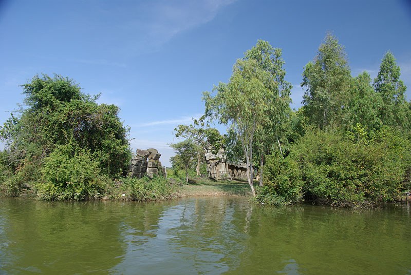
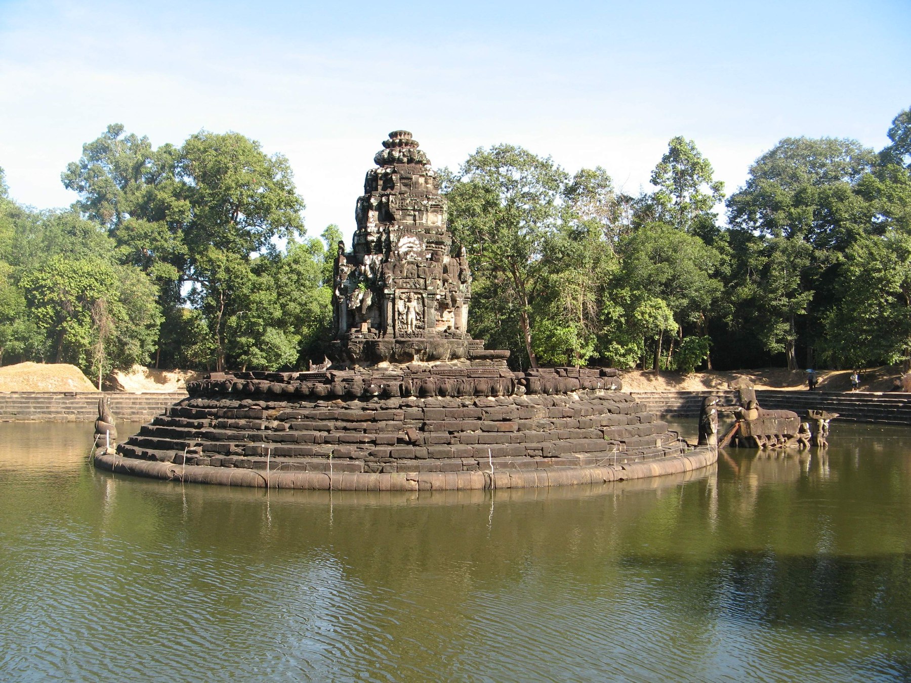
Water also belonged to the sacred and political presentation of Angkor. An island temple within a broad reservoir made an extraordinary visual relationship between built form and its setting. At the West Baray, the West Mebon occupied an artificial island; at Neak Pean, a sanctuary and basins formed another carefully composed waterscape. Their presence cautions against separating utility and ritual too sharply. A place could participate in water management and carry religious meaning at the same time.
The West Baray offers a particularly revealing environmental archive. Researchers recovered a sediment core from its southwestern part and examined changes in sediment delivery, composition, and aquatic life. The record indicated lower water levels and reduced sediment input during the major drought intervals of the fourteenth and fifteenth centuries. It also showed longer changes in the reservoir’s ecology. Crucially, the researchers could not always disentangle climate from human activity: reduced inflow, altered land use, and changes in management could leave overlapping signals. sediment research in the West Baray
That limitation is historically productive. It discourages the easy division of causes into “nature” on one side and “people” on the other. A shortage of rain could prompt a change in water routing. A settlement’s contraction could reduce maintenance. A bank repaired in one location might redirect pressure elsewhere. The sediment is evidence of a changing system, rather than a written explanation of why particular people chose to stay, move, repair, or abandon a channel.
When variability became dangerous
A major climate reconstruction published in 2010 used long-lived trees in southern Vietnam to investigate regional monsoon conditions. It identified prolonged droughts during the late Angkorian centuries, punctuated by exceptionally wet years. The evidence is a regional proxy, not a rain gauge that stood beside Angkor Wat. Even so, it provided an independent environmental record against which archaeological signs of damage and alteration could be considered. The authors presented climate as a contributing factor in Angkor’s decline, with other processes still in play. Buckley and colleagues’ tree-ring reconstruction
The combination of drought and very heavy rainfall is important. A water network adjusted to one range of conditions might struggle when those conditions changed sharply. Too little flow could make storage and distribution difficult; too much could erode channels and carry sediment into other parts of the system. Long service did not make the infrastructure immune to new demands. The same connections that moved water usefully across the city could transmit a disturbance beyond its original location.
A 2018 study explored this problem through a model of Angkor’s water-distribution network. It examined how erosion and sedimentation might trigger cascading failures when flow increased. The model suggested particular vulnerability in highly connected upstream components. This was a test of systemic susceptibility, not a film of a single medieval flood or proof of the exact sequence of the city’s decline. Its value lies in showing how damage could spread through infrastructure that had become extensive and interdependent. a 2018 model of the water network
The difficulty of choosing an end date
The year 1431 often serves as Angkor’s dramatic endpoint, associated with an Ayutthayan attack. Archaeology has made that date harder to use as a boundary between a fully functioning metropolis and an empty landscape. Sediment from the moat of Angkor Thom indicated declining land-use intensity within the administrative core well before the conventional fifteenth-century collapse. By the later fourteenth century, evidence of maintenance there had weakened. This suggests a protracted change in the elite urban center rather than a single moment that emptied it. a 2019 study of Angkor Thom’s moat
The qualification “there” is essential. A core from one part of a moat does not record every household across the region. Different places could follow different trajectories, and the departure of a court need not entail the departure of all cultivators, religious communities, or craftspeople. The evidence allows a more precise question than “When did Angkor fall?” Historians can ask which activities diminished, in which locations, and over what timescale.
Excavation around Angkor Wat reinforces that approach. Researchers found changing occupation patterns, including a period of reduced or altered use followed by renewed activity on residential mounds. Use continued into the centuries conventionally described as post-Angkorian, alongside the temple’s importance as a Buddhist pilgrimage site. This does not erase the political and demographic contraction of the wider capital. It shows that the history of a monument, a neighborhood, a royal administration, and a regional population need not share one ending. excavations around Angkor Wat
The familiar abandoned-city image obscures precisely these differences. Stones weather dramatically and trees make powerful photographs. Continued religious visits, changing house locations, or a field cultivated beside an older embankment can leave less spectacular evidence. Recovering such activities restores human choices to a history too easily reduced to a contest between engineering and climate.
Water after the imperial capital
Angkor’s hydraulic remains are still involved in living landscapes. APSARA National Authority describes restoring parts of the ancient system after severe floods in 2009, 2010, and 2011, with substantial work undertaken in 2012. Channels and reservoirs have again been used to divert and retain water. These interventions are modern projects addressing modern conditions; they should not be mistaken for an unchanged survival of the medieval network. Their importance is that the old earthworks remain consequential. APSARA’s account of hydraulic restoration
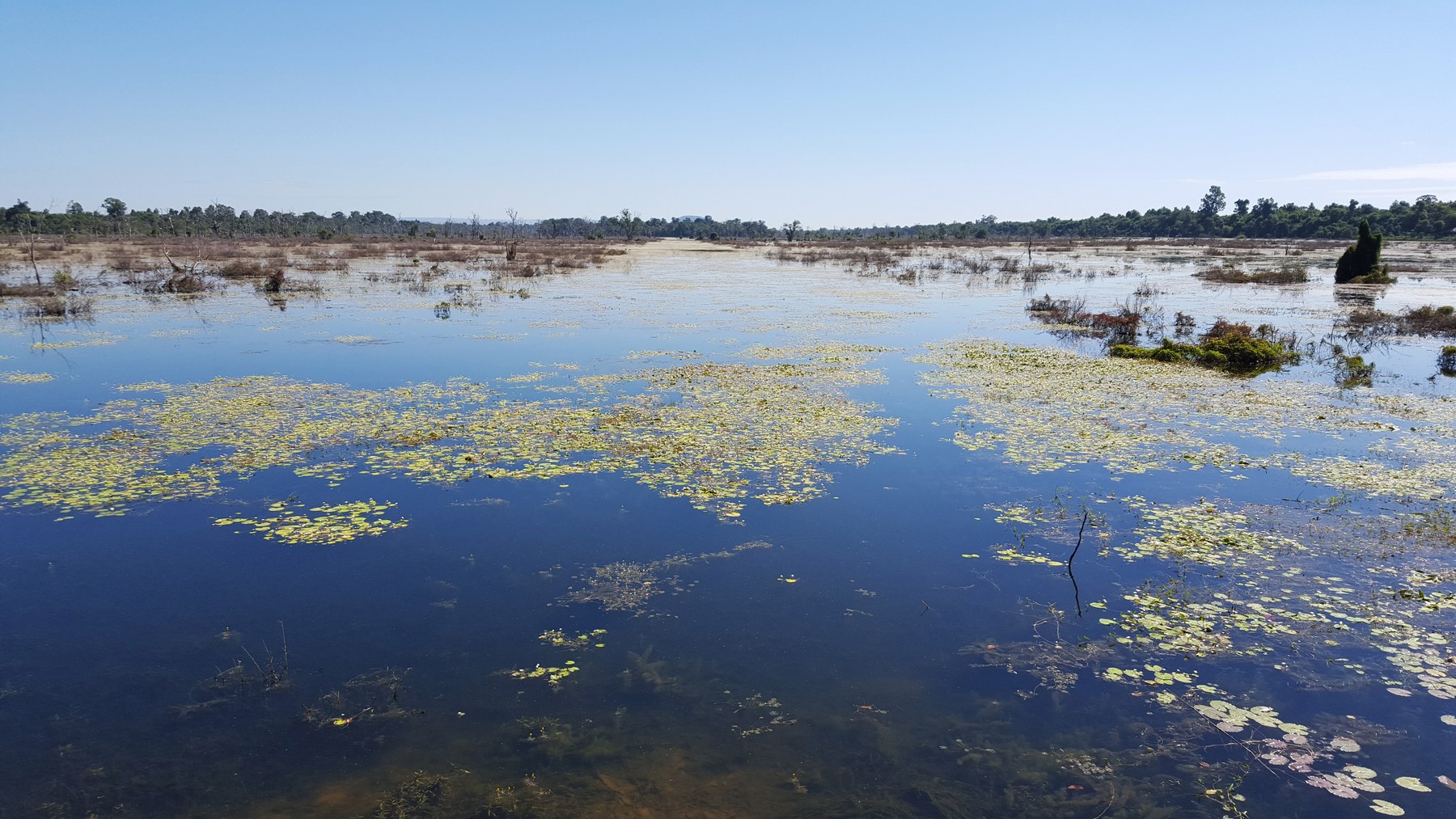
Seen this way, the West Baray’s broad horizon represents more than a lost imperial achievement. It belongs to a history in which people repeatedly altered the relationships among water, settlement, worship, and authority. Angkor grew because those relationships could be made productive across a vast area. Its later transformation exposed the difficulties of maintaining them under changing environmental and political conditions.
There is no need to choose between admiration and explanation. The channels and banks attest to extraordinary practical knowledge, while the evidence of stress reveals how much work such knowledge required in use. Angkor’s water city was sustained over generations. Understanding its transformation means giving that long duration, and the people who continued to inhabit its landscape, as much attention as the image of collapse.
Sources and further reading
- UNESCO World Heritage Centre, Angkor Monuments, multiple capitals, hydraulic structures, and landscape context; protected park is not equivalent to the full medieval settlement.
- Evans et al., A comprehensive archaeological map of the world’s largest preindustrial settlement complex at Angkor (2007) Landscape extent and ground survey plus remote sensing. Mapped area and urbanized area must not be conflated.
- Evans et al., Uncovering archaeological landscapes at Angkor using lidar (2013) Topography, planned urban forms, and features obscured by forest.
- Carter et al., Prasat and Pteah: Habitation within Angkor Wat’s temple enclosure (2022) Domestic archaeology and limits of survival of organic buildings.
- Klassen et al., Diachronic modeling of the population within the medieval Greater Angkor Region settlement complex (2021) Estimate of 700,000–900,000 for the Greater Angkor Region at thirteenth-century apogee; a model, not a census.
- Fletcher et al., The water management network of Angkor, Cambodia (2008) Large connected network, collection/storage/distribution, evolution from ninth century. Published in Antiquity 82 (2008); online date differs.
- Klassen and Evans, Top-down and bottom-up water management: A diachronic model of changing water management strategies at Angkor (2020) Community temples and state infrastructure, changing relationships, no single all-powerful hydraulic bureaucracy inferred.
- Day et al., Paleoenvironmental history of the West Baray, Angkor (Cambodia) (2012) Reservoir size and sediment indicators; cannot fully separate climatic from human causes.
- Buckley et al., Climate as a contributing factor in the demise of Angkor, Cambodia (2010) Regional droughts and intense monsoons; evidence from Vietnamese trees is a regional proxy, not an Angkor rain gauge.
- Penny et al., The demise of Angkor: Systemic vulnerability of urban infrastructure to climatic variations (2018) Cascading erosion/sedimentation dynamics. A vulnerability model, not a literal reconstruction of one dated flood.
- Penny et al., Geoarchaeological evidence from Angkor reveals a gradual decline rather than a catastrophic 15th-century collapse (2019) Declining land use/maintenance in administrative core before conventional 1431 endpoint; cannot generalize a core to every neighborhood.
- Carter et al., Temple occupation and the tempo of collapse at Angkor Wat, Cambodia (2019) Different local occupation chronology; continued/reconfigured use into post-Angkorian centuries.
- APSARA National Authority, Restoration of Angkor Hydraulic Network (2021) Modern repairs after floods and reuse of water network; authority’s account, not proof medieval floods never occurred.