
Reading Hoi An: The River, Houses and Communities of a Trading Port
A historical guide to Hoi An’s covered bridge, merchant houses, assembly hall and ceramics museum—and the river networks and continuing repairs that make sense of them.
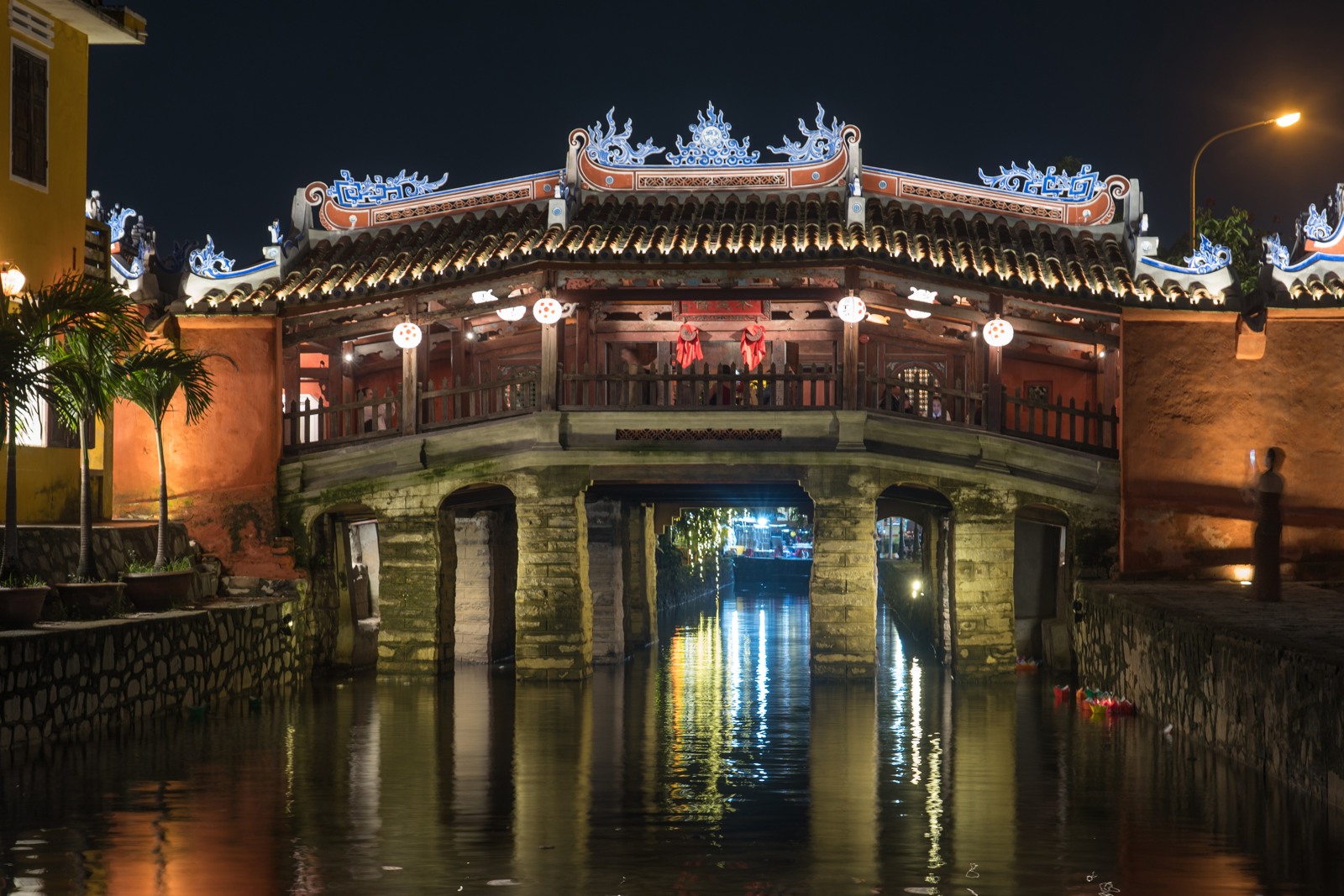
In 1719, Nguyễn Phúc Chu gave Hoi An’s covered bridge the name Lai Viễn Kiều, associated with welcoming people from afar. The name belonged to a small crossing, not a harbour entrance. Yet it expressed something essential about the town around it: movement between communities, trading places and systems of belief. The bridge is a useful place to begin reading Hoi An—not because it contains the whole history, but because it makes the town’s connections unusually visible. The local heritage authority’s account places it within the commercial relationship between the Nguyễn rulers and Japanese traders.
Its familiar label, the Japanese Covered Bridge, can encourage a misleadingly simple question: which year was it built? The authority’s history of its renovations acknowledges that the exact beginning and completion dates remain uncertain. A confidently repeated date is less useful than the evidence for successive communities maintaining the crossing. Repairs in 1763 and 1817 involved the Minh Hương community; later generations continued the work.
That history did not stop when the bridge became a monument. The major restoration begun in December 2022 renewed a structure suffering from serious deterioration. The official report published in January 2025 says that nearly sixty per cent of its timber volume was retained. It also explains decisions about replacement elements and restored colour. The project account treats documentation, repair and material survival as connected problems.
Look, therefore, at the bridge as a roofed passage and a religious place, not simply an old object whose value depends on looking weathered. Its changing fabric introduces the central question of this guide: how does a working town preserve the form of a historic port while its buildings, livelihoods and uses continue to change?
The river is part of the street plan
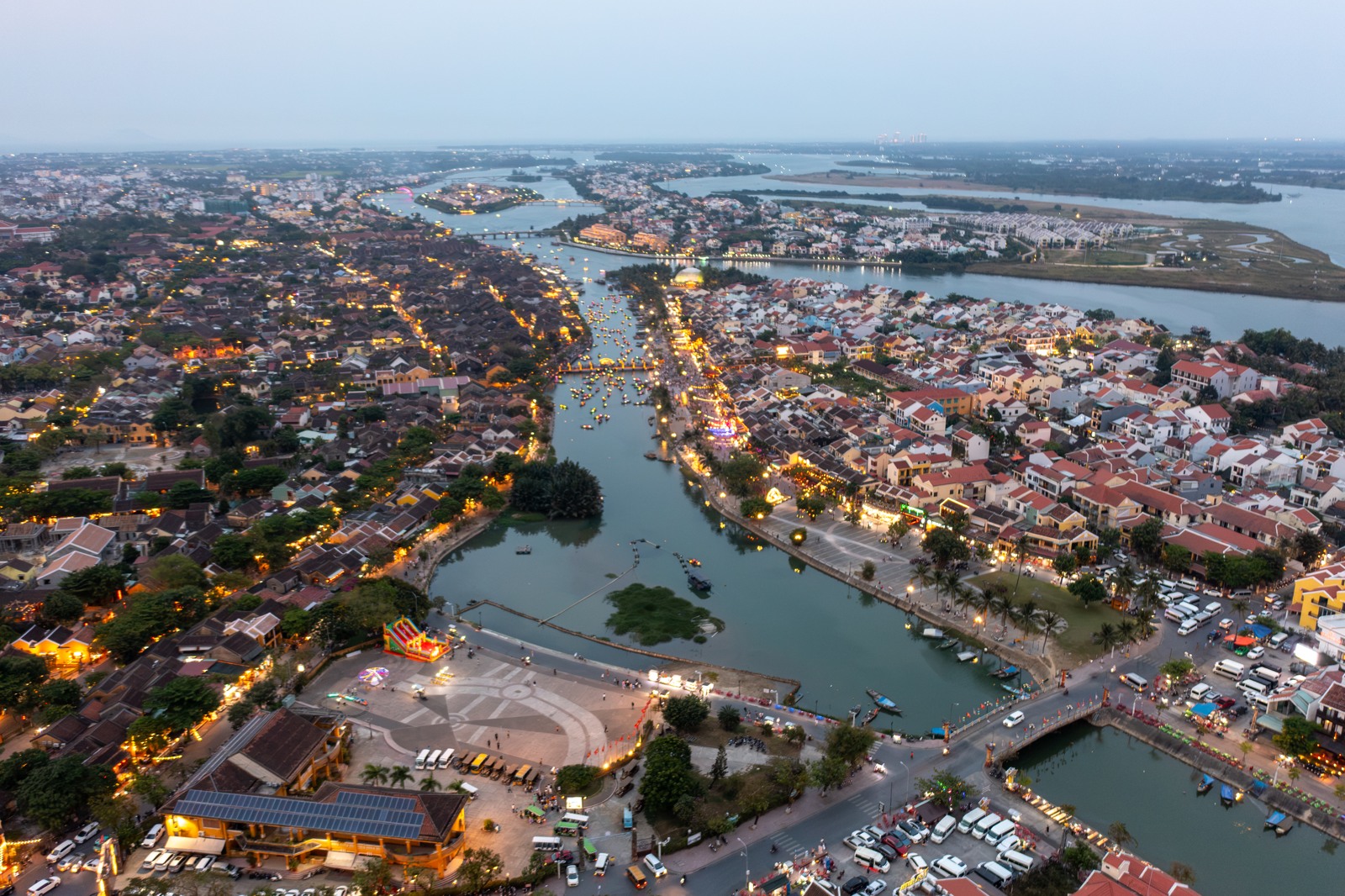
From the bridge area, turn attention towards the waterfront rather than immediately collecting another monument. Hoi An’s commercial geography makes more sense from the relationship between streets and water. UNESCO’s description of the town identifies parallel river-facing streets crossed by lanes, with buildings accommodating customers towards the street and goods arriving from the water. The visible layout is evidence of movement: people approaching one side, merchandise another.
But a port is not explained by ships alone. A recent study of the highland trade routes traces products such as cinnamon, agarwood and honey from upland communities through intermediate markets towards Hoi An. The Thu Bồn and other river systems connected collectors, processors, transporters and merchants. Settlements including Kim Bồng, Trà Nhiêu and Phú Chiêm belonged to that network. The waterfront was a point of concentration within a much larger landscape.
This changes what to look for. An attractive river view can be read as the meeting of two directions of trade: inland production moving down towards the coast, and maritime connections reaching outwards. Neither direction functioned without the other. The celebrated foreign merchant is only one figure in a chain that also included people whose work happened far from the town’s best-preserved façades.
Land registers help restore those less visible surroundings. A heritage-centre study of early nineteenth-century cadastral records examines seventeen villages recorded in 1814, 1815 and 1818. Their plots included agricultural land, homes, places of worship and burial grounds. Commerce, craft production and cultivation were interwoven. Hoi An was not an international enclave floating free of Vietnamese village society.
Tấn Ký: a house was also a business
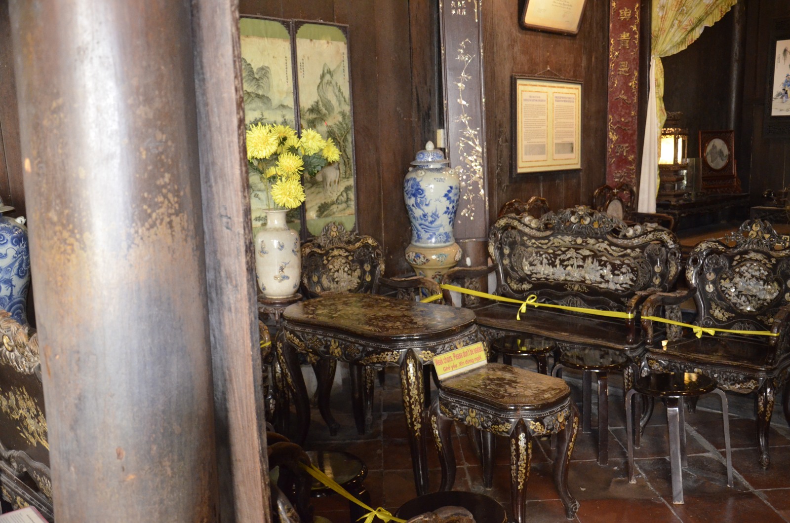
At Tấn Ký House, 101 Nguyễn Thái Học, the most revealing feature is not a single antique furnishing. It is the depth of the building. The official monument dossier describes a narrow, elongated arrangement connecting Nguyễn Thái Học with Bạch Đằng behind it. Successive built sections and a courtyard make the house more than the façade encountered from the street.
The same dossier records uses that overlap rather than fit modern categories: trading, storage, rental, residence and family worship. It identifies an opening in the upper floor used to move goods. An architectural detail that might otherwise seem incidental thus becomes evidence of work. The house’s circulation had to accommodate merchandise as well as people, while domestic and ceremonial spaces occupied the same property.
The city tourism authority’s account dates the house to the late eighteenth century and emphasises the contribution of Kim Bồng carpenters. Its carved woodwork should be approached as skilled local production, not merely a set of labels assigning one feature to Vietnam, another to China and another to Japan. Connections across the trading world mattered, but someone still selected timber, cut joints and maintained a roof in this particular environment.
A useful way to examine the interior is to ask how its spaces differ. Where does a public-facing room give way to a more inward-looking one? How does the courtyard interrupt the long roofed plot? What is being displayed as family memory rather than commercial stock? Respect any barriers and occupied areas: a heritage house is not permission to treat every room as an unrestricted exhibit. The building’s interest lies precisely in the uses that a purely scenic view would overlook.
Phước Kiến: trade needed a community
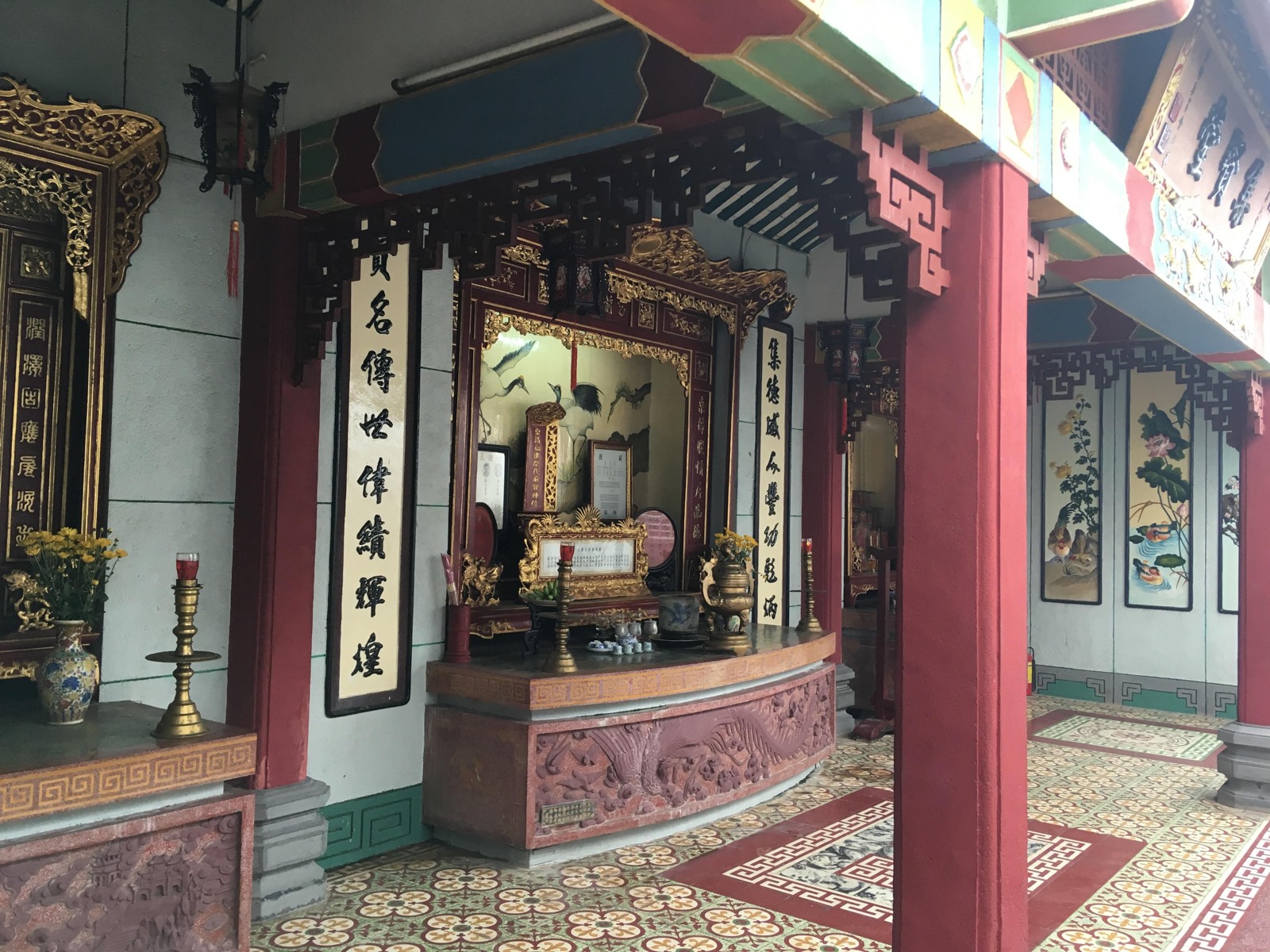
The Fujian, or Phước Kiến, Assembly Hall at 46 Trần Phú shifts the scale from household to community. Its official monument record describes a place for worshipping deities and predecessors, gathering people from the same region, and helping one another in business and daily life. Commerce here did not take place in a separate, secular compartment. Religious observance and communal support helped organise the social world in which trading relationships operated.
The principal worship of Thiên Hậu, associated with protection at sea, gives the maritime setting a particularly direct expression. The dossier also identifies Quan Âm and other figures within the complex. Do not flatten these into a generic category of “Chinese decoration.” Their positions and functions belong to a layered religious environment.
Follow the sequence of thresholds, courts and halls rather than looking only for the most elaborate altar. The arrangement separates the busy street from inner ceremonial spaces. It also reminds a visitor that the impressive frontage is not all the building is for.
Nor is everything in view of one age. The official record documents major rebuilding in 1970–1974, including work on gateways and courtyards. A recent-looking element need not be an intrusion into an otherwise untouched seventeenth-century scene. It may be part of the community’s continuing investment in the place. Ask what a feature does and when it was renewed before treating its apparent age as a verdict on authenticity.
At the ceramics museum, broken things widen the map
The Museum of Trade Ceramics at 80 Trần Phú supplies a different kind of evidence. A merchant house gives trade a spatial form; an excavated fragment gives it a material trace. The museum was established in 1995 with Japanese expert cooperation. Its January 2026 account describes ceramics extending from the ninth and tenth centuries to the nineteenth, recovered from archaeological sites in Hoi An. Those dates should not be collapsed into one uninterrupted golden age.
The heritage authority’s archaeological review explains how investigations changed the town’s history. Discoveries in 1989 identified Sa Huỳnh sites and Cham remains, while subsequent excavation programmes examined earlier burials, urban sites and maritime material. The review identifies Japanese Hizen ceramics and Vietnamese Chu Đậu wares among the material associated with the trade museum. The resulting picture is deeper and less uniform than a story beginning with the arrival of European or Japanese merchants.
When looking at a vessel or sherd, separate three questions: where was it made, where was it recovered, and how is its date established? A foreign-made object is evidence of circulation, not automatic proof that a merchant from that country personally carried it to Hoi An. Goods could change hands. A find’s archaeological setting matters as much as its decorative style.
The museum is therefore most useful as a partner to the streets outside. It can challenge the assumption that the town’s surviving architecture and its earliest trade belong to the same moment. The house fronts, religious institutions and buried objects preserve different kinds of time.
A town maintained, not a town stopped
Hoi An entered the World Heritage List in 1999 as an unusually well-preserved trading town. Yet preservation here cannot mean that every timber has remained in place since the port’s busiest centuries. UNESCO explicitly recognises the periodic renewal necessary for wooden buildings. The continuity lies partly in plots, relationships between buildings, construction practices and uses—not only in the survival of individual pieces of material.
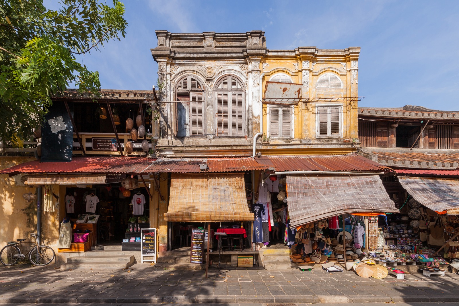
This distinction matters on an ordinary stretch of shophouses. Read the row as well as the exceptional monument: the rhythm of entrances, the roof line, the relationship between business and residence, and the passages leading away from the main street. A collection of isolated “must-see” buildings would lose the urban connections that make them intelligible.
Water, which helped create the port, also remains a conservation problem. The heritage authority’s priorities for 2026 describe the difficulties caused by flooding in 2025 and include disaster preparation, assessment of deteriorating structures and better documentation among continuing work. This is an institutional account of challenges and intentions, not a guarantee that every building is currently unaffected or accessible.
There is no need to choose between declaring Hoi An perfectly preserved and dismissing it as a tourist stage. The more interesting task is to distinguish surviving form, repaired material, continuing worship, commercial adaptation and modern presentation. The bridge, house, hall and museum offer different evidence for doing that.
Putting the evidence into a walk
A compact historical route can connect the Japanese Covered Bridge, the Bạch Đằng waterfront, Tấn Ký House on Nguyễn Thái Học, and the ceramics museum and Phước Kiến Assembly Hall on Trần Phú. Treat this as an interpretive sequence, not a timed itinerary: conditions, opening arrangements and your choice of ticketed interiors may change the order. The heritage authority confirms the ceramics museum’s address at number 80; the house and hall addresses are recorded in their monument dossiers.
At each stop, carry one question onwards. At the bridge, ask who maintained connections. At the river, ask where goods came from. In the house, ask how trade occupied domestic space. In the hall, ask how a community organised trust and worship. In the museum, ask what an object can—and cannot—prove.
Planning note, checked 27 October 2026, Vietnam time: confirm ticket coverage, opening arrangements and any weather-related restrictions through the heritage authority or an official ticket point before visiting interiors. The heritage centre’s January 2026 visitor notice and the city’s later announcement effective 10 August 2026 document different stages of admission arrangements. This guide does not quote a price or promise that one ticket covers every stop. Ask permission before photographing worshippers or private domestic areas, and follow local signs around repairs.
What this walk offers is not a recovery of one perfect day in the old port. It is a way to recognise how a port worked, and how the evidence for it survives in a town that still has other things to do.