Reading Merv: Cities, Water and the Lives of Earthen Walls
A guide to the neighbouring cities of the Murghab oasis, where the spaces between monuments explain as much as the monuments themselves.
If you’re planning a visit to Merv, start with a map that shows more than one city. The great mound of Erk Kala, the broad enclosure of Gyaur Kala and the medieval walls of Sultan Kala belong to different arrangements of urban life. They occupy neighbouring ground in the Murghab oasis, in present-day Turkmenistan. As you move between them, you’re following a history that spread sideways as well as upwards.
It’s easy to focus on Merv’s most striking buildings and miss the city around them. A dome holds your attention; the streets and neighbourhoods that once surrounded it are harder to spot. At Merv, the distances between monuments are part of the evidence: where inhabitants enclosed a new district, where an older centre changed its function, and where the needs of water, trade and government produced a different settlement.
The UNESCO description identifies a sequence of adjacent walled cities as a central reason for the site’s importance. It also places the ruins within a much longer history of settlement in the oasis. Keep those two scales separate as you explore. The oasis has Bronze Age sites, but that doesn’t mean every part of the historic city has Bronze Age buildings beneath it.
So give yourself a little time before heading straight for the largest dome. Find the outlines of the cities first. Then ask what each surviving structure can tell you about the people and resources once gathered inside them.
Begin with the river, even when it is out of sight
The Murghab flows north from Afghanistan and spreads into a delta near the southern edge of the Karakum Desert. In Tim Williams’s study of Merv’s urban landscape, the story starts with that geography. The oasis offered a cultivated setting for a city on routes connecting Iran, Central Asia and regions farther east.
Picture an oasis and you might think of a welcome patch of water and shade. Keeping a whole city alive there took much more. Water had to reach cultivated land and inhabited districts in usable quantities. Routes depended on places where travellers and animals could obtain supplies, and cities depended on the agricultural work that made those supplies available.
With that in mind, even the ground between the monuments becomes worth a closer look. The flat ground around a wall is not merely empty space between attractions. It belongs to the relationship between enclosed settlement and its supporting landscape. A palace needed food and water as surely as a merchant’s household did, even if its surviving architecture makes a stronger claim on our attention.
The comparison with Angkor’s water city is useful without making the two places identical. Both encourage a question that a monument-only itinerary can miss: what had to happen outside a famous building for life inside it to continue?
Erk Kala and the changing scale of a city
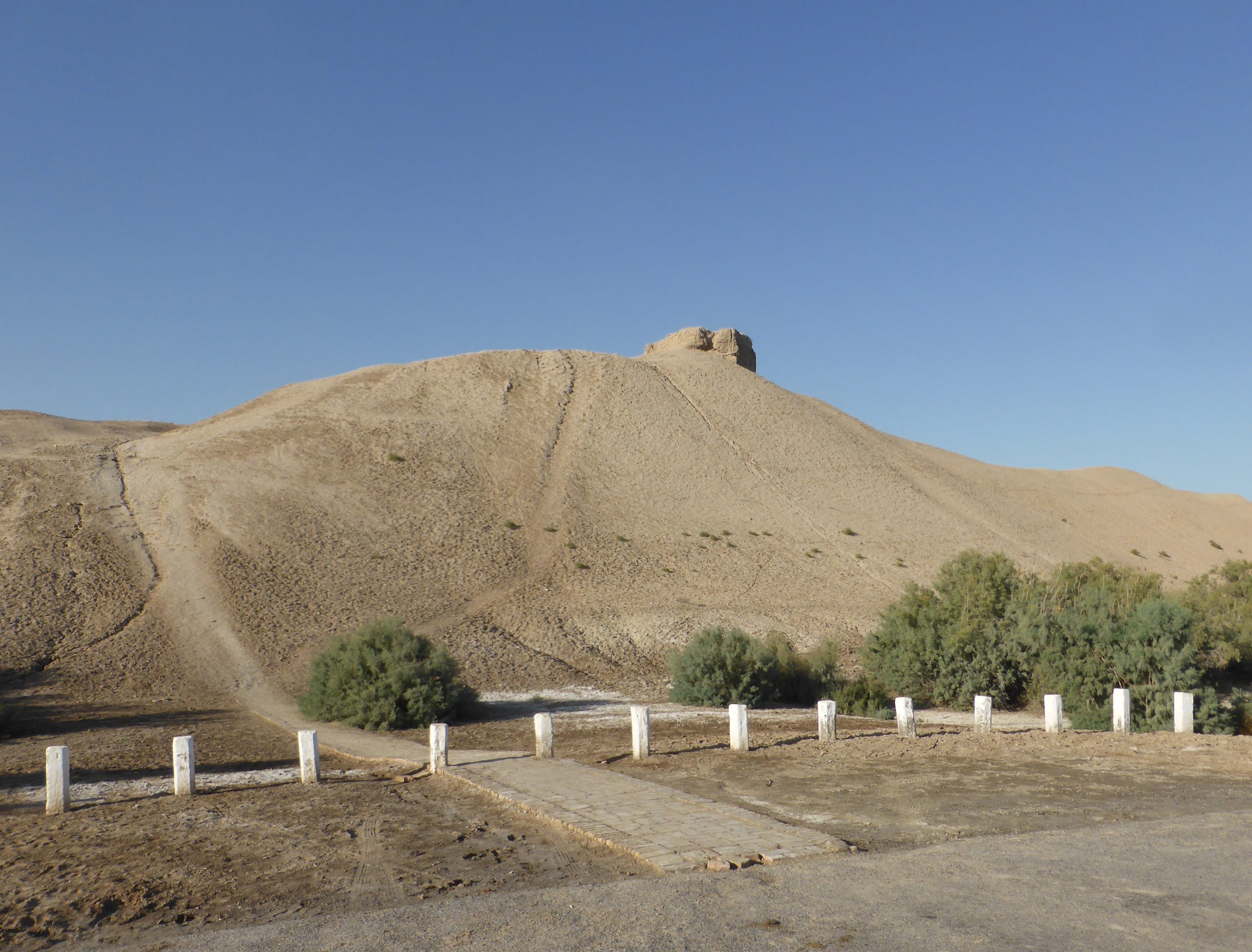
Erk Kala is the early fortified core. Williams dates its beginnings to around the sixth century BCE and describes its later incorporation as the citadel of the much larger Hellenistic settlement now called Gyaur Kala. The earlier enclosure did not simply vanish when the larger city appeared. Its relationship to the surrounding settlement changed.
Look closely at Erk Kala’s raised perimeter. What resembles a hill is built material that has accumulated and changed over centuries. The visible surface is the result of construction, collapse, erosion and later activity. A date assigned to a settlement’s foundation does not date every stretch of earth now in view. Remembering that helps you enjoy the view without mistaking it for a perfectly preserved scene from one ancient moment.
Gyaur Kala: an enclosure with more than one history
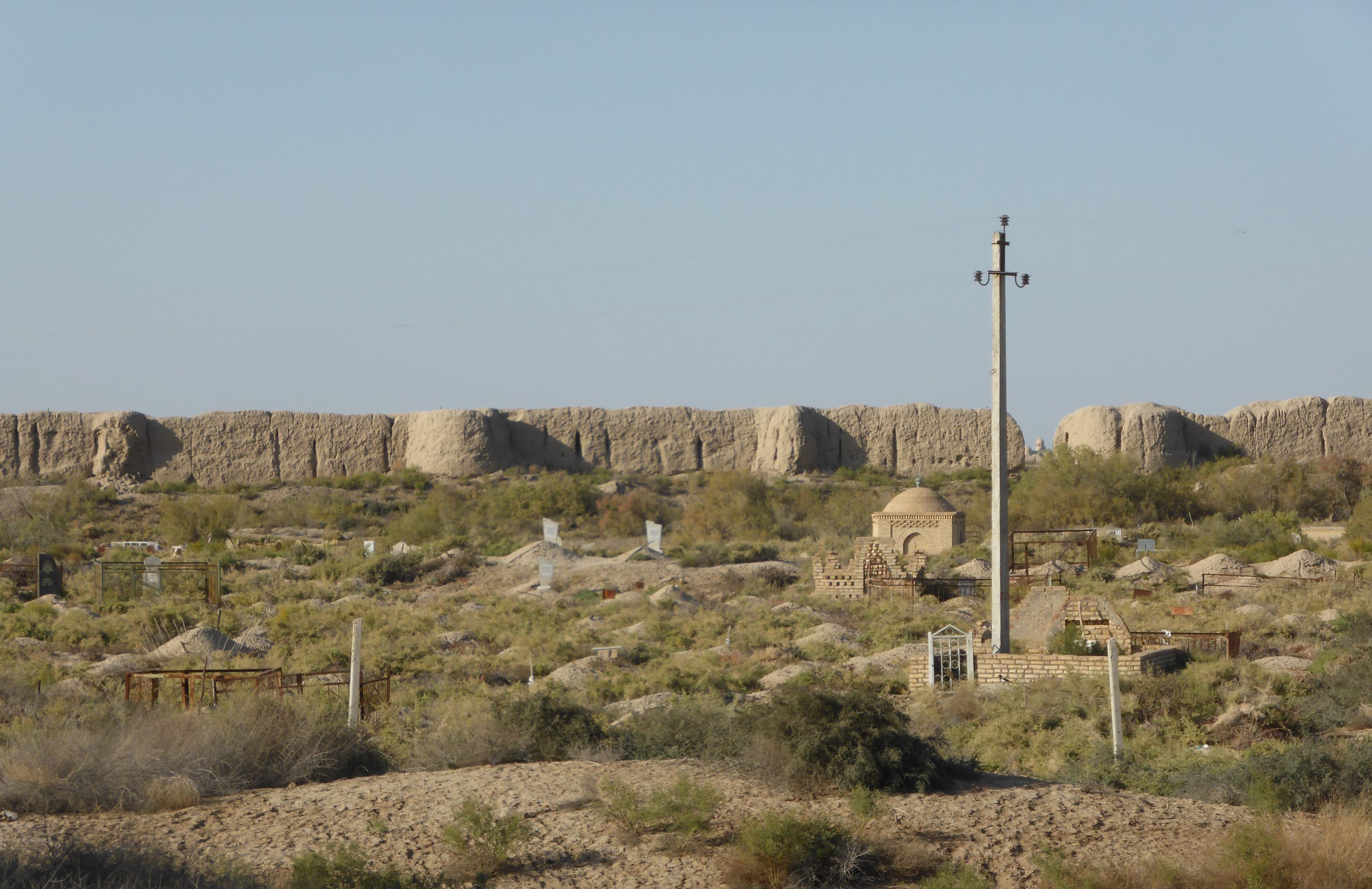
Gyaur Kala’s roughly square plan makes the jump in size easy to see. UNESCO records a Buddhist stupa and monastery among its excavated structures, alongside remains associated with later Islamic occupation. The archaeological record contains changes in religious life as well as shifts in political rule.
You could arrange those remains into a tidy story: one community leaves, another arrives. The map alone doesn’t tell us that. Buildings can change use, neighbourhoods can persist and a new political centre can attract activity without emptying every older street.
The Ancient Merv Project’s research agenda treats the transition between Gyaur Kala and Sultan Kala as a question requiring investigation. It asks about the timing and scale of occupation in the developing western city and the continuation of activity in the older enclosure. A dynasty’s name beside each coloured shape on a tourist plan can’t settle those questions.
That is a useful question to carry between the walls: did this place lose its inhabitants, its political importance, or only some of its former functions? Those possibilities leave different traces. Archaeology can investigate them through buildings, pottery, deposits and production debris, even where a visitor sees little more than an uneven surface.
From a provincial centre to a centre of power
Merv mattered to events far beyond its oasis. In the eighth century, Abu Muslim used Khurasan as the base for the movement that brought the Abbasids to power. The Metropolitan Museum’s account of coins from Nishapur connects his authority and coinage with his base at Merv. Money preserves a kind of political evidence that monumental ruins cannot provide alone.
Calling Merv a stop on the Silk Roads can understate this role. The city was not always a place through which other people’s history passed. At times, people based here gathered resources, supplied armies and helped change who ruled. Trade routes and political centres supported one another, but their relationship was never simply peaceful exchange.
Histovia’s guide to reading Bukhara offers a complementary urban comparison. In both places, the familiar language of the Silk Road becomes more useful when attached to particular institutions, buildings and periods.
Great Kyz Kala: an imposing building with an unsettled biography
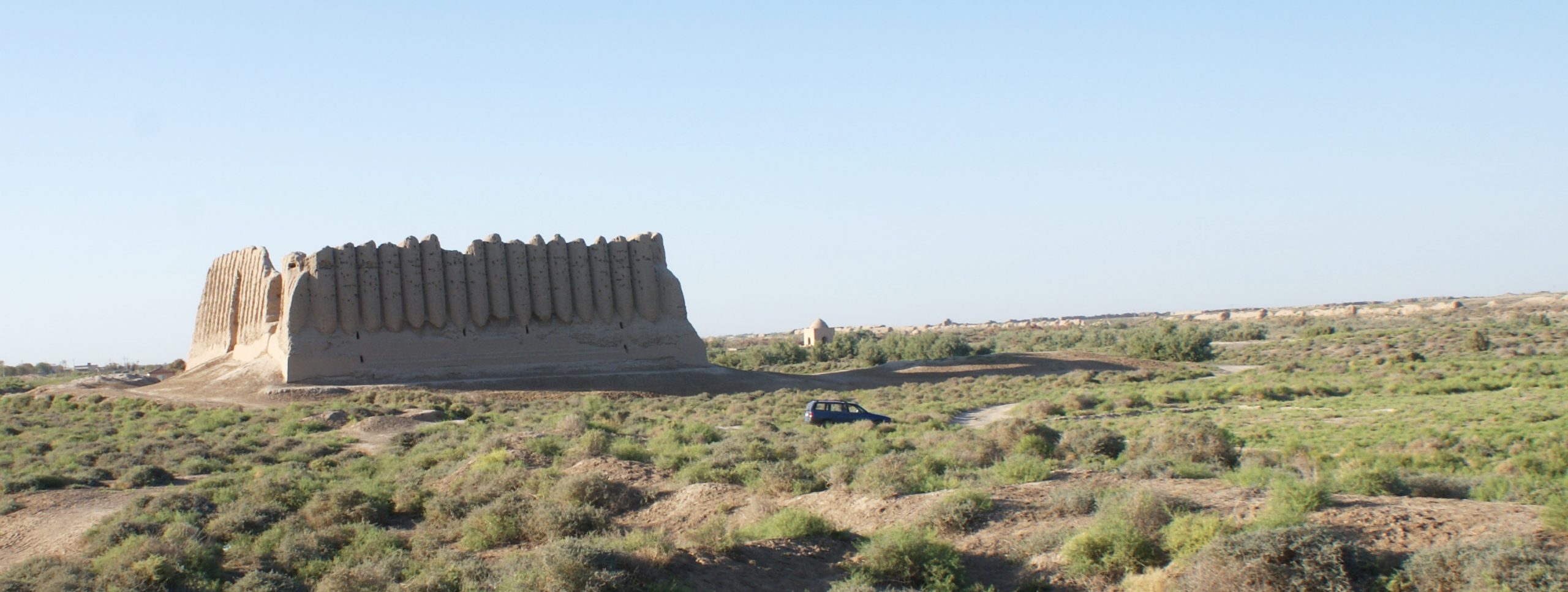
The Great Kyz Kala stands out through the repeated vertical forms of its outer walls. It belongs to a family of Central Asian buildings often called köshks. Its striking appearance has made it easy to photograph and harder to explain: walls that look defensive don’t tell you everything about what happened inside.
A 2018 excavation report by Tim Williams and colleagues proposed construction in the eighth or ninth century CE. The work identified well-appointed upper rooms, including a large hall, and lower spaces for practical functions and storage. This evidence supports interpretation as a semi-fortified palatial complex. If an older guidebook gives you a confident label, it’s worth comparing it with this newer research.
It helps to think floor by floor. Access, storage and reception are different activities, and a building can organise them vertically. A visitor looking only at the dramatic exterior may miss the household and service arrangements that helped make an elite residence work.
There’s also a story behind how we’ve come to understand the building. Excavated deposits, standing walls and three-dimensional recording contribute different kinds of information. A digital reconstruction is a reasoned proposal built from that evidence, not an independently surviving picture of the building’s original appearance. Where an interpretation remains uncertain, a good explanation should leave the uncertainty visible.
Sultan Sanjar’s mausoleum and the missing complex
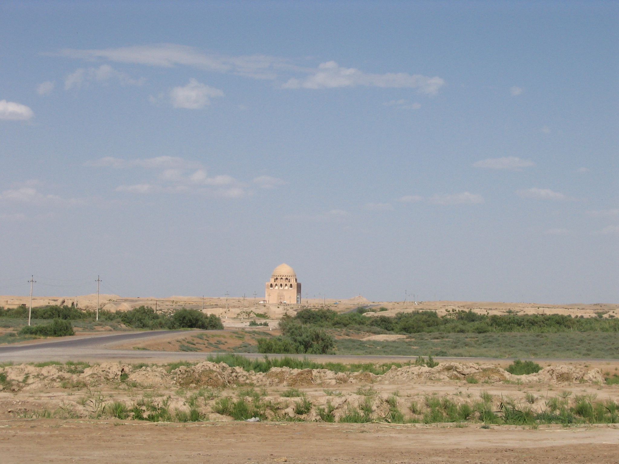
The great mausoleum in Sultan Kala commemorates the Seljuk ruler Ahmad Sanjar, who died in 1157. Today it’s so imposing that you might assume it always stood on its own. Archnet’s architectural account describes it as part of a larger religious and palatial setting, with a mosque adjoining its western side. The surrounding buildings have not survived in the same way.
Read the surviving cube and dome together. The upper galleries, arches and transition to the dome show how a monumental interior was enclosed. Looking at how these parts fit together brings the designers and builders into view alongside the ruler who gave the monument its name.
Then look outwards. What appears to be an isolated landmark was once embedded in an urban and ceremonial environment. The missing structures mattered to how people approached, used and understood it. A surviving monument is often the strongest piece of an incomplete arrangement.
1221 was a catastrophe, but the landscape continued
The Mongol sack of Merv in 1221 brought mass killing and destruction. Medieval accounts conveyed the enormity of the event through extraordinary casualty figures. The Ancient Cities of Merv handbook cautions that those numbers are probably far too high. Repeating them as a verified population count confuses testimony to disaster with reliable enumeration.
The same handbook notes evidence for occupation, reused housing and industry after the invasion. Later, a new Timurid centre developed to the south in the early fifteenth century, at the enclosure now known as Abdullah Khan Kala. The historical landscape did not stop changing when medieval Sultan Kala suffered its greatest catastrophe.
The violence was no less devastating because some life continued. The next question is how people managed to live in the changed conditions afterwards. A ruin can mark a terrible rupture without proving that every household, craft or route ended at the same instant.
For a visitor, Abdullah Khan Kala is therefore more than an optional extra after the famous medieval monuments. It’s a useful reminder that the familiar rise-and-fall story leaves a great deal out. Comparing its enclosure with the older centres shows that the oasis continued to generate new arrangements of settlement and authority.
Compare the photographs, not just the skyline
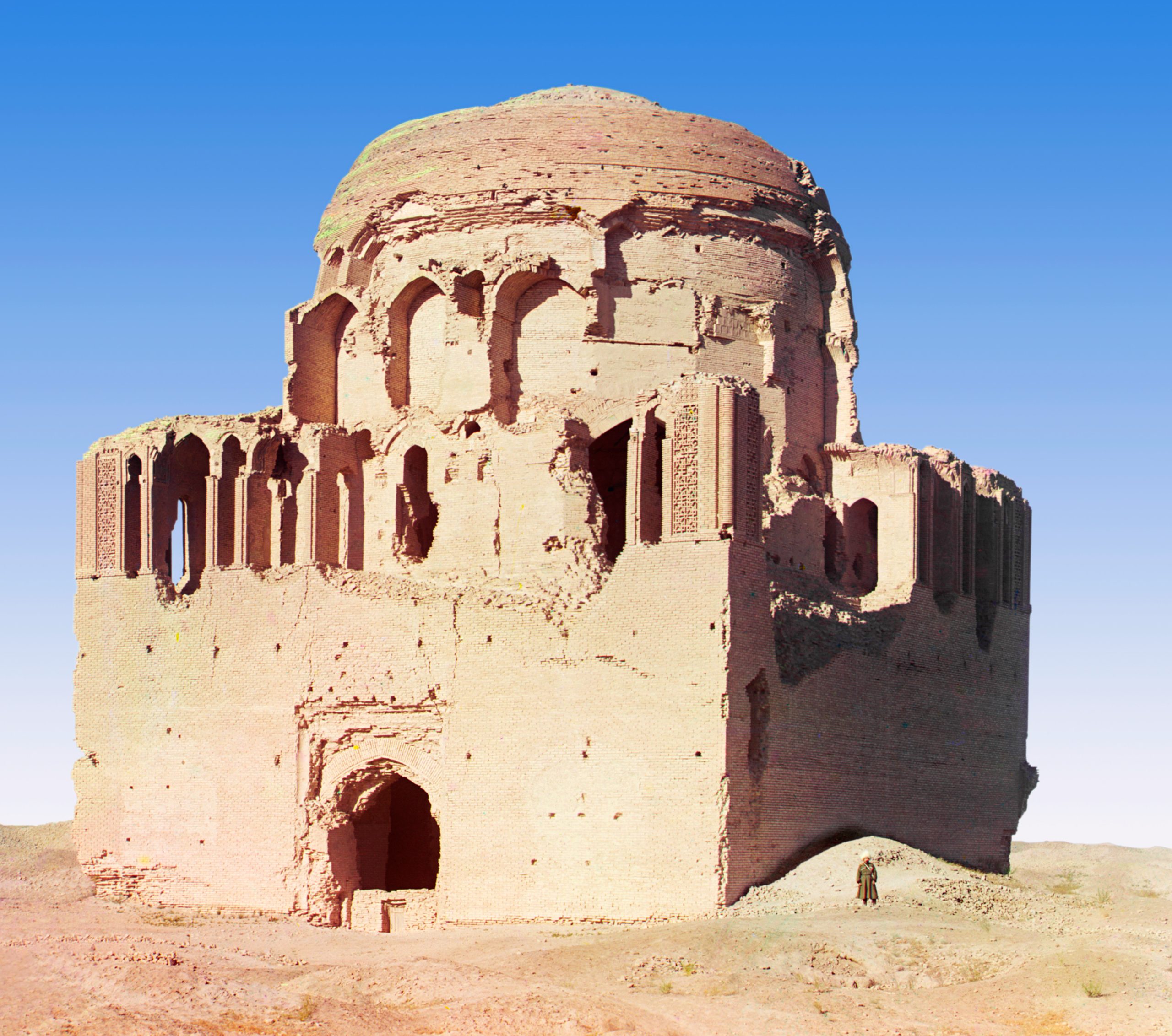
Sergei Prokudin-Gorskii photographed the Sanjar mausoleum in the early twentieth century. The surviving image reproduced here shows a building in a different condition from the restored monument in the modern photograph. Put the two views side by side and you can see why the dates matter.

UNESCO’s assessment acknowledges that some twentieth-century interventions in Merv’s religious structures did not follow present conservation principles. It also recognises the need to stabilise buildings that remained living monuments. Preservation involves choices about fabric, appearance and continuing use; the familiar photograph may record the outcome of those choices.
Comparing dated images offers a practical way to notice that history. Ask which surfaces have been repaired, which openings have changed and which neighbouring remains appear in each view. Avoid assuming that the older photograph is a picture of the monument before any intervention. It records an earlier stage, with its own prior history.
Why an earthen city needs continuing care
Earth is both the material of much of Merv and a source of its vulnerability. The conservation project’s explanation identifies groundwater changes, wind-blown sand and the activities of animals and people among the pressures on standing structures. Damage can accumulate at the base of a wall long before the whole mass falls.
Much of the conservation work is easy to overlook: recording a surface, supporting vulnerable fabric, improving drainage and monitoring the results. The knowledge of local park staff matters to continuity between research campaigns. If a monument looks much the same from one year to the next, that may be because someone has kept caring for it.
Visitors can help by staying on permitted routes and respecting barriers, rather than climbing fragile walls for a better photograph. Do not collect pottery or move fragments. A small object can preserve information through its position and relationship to other material; its value is not limited to how impressive it looks in the hand.
This is a guide to understanding the site, not a statement of current admission hours or travel permissions. Confirm access, transport and any local restrictions with the park or a qualified local operator before visiting. Plan for the distance between enclosures rather than assuming that a list of five monuments describes five adjacent stops.
Before you leave, have another look at the map. Merv becomes clearer when the old citadel, the changing urban enclosures, the elite residence and the restored mausoleum remain different kinds of evidence. The reward is a city that can be read beyond its most photogenic buildings: a succession of places where water, work, belief and power had to be organised together.