
Civilizations & Empires
Cahokia: The Fields, Mounds and Neighbourhoods Behind a North American City
The great earthworks were only part of Cahokia. Houses, food, migration and changing interpretations reveal the inhabited landscape behind a monumental centre.
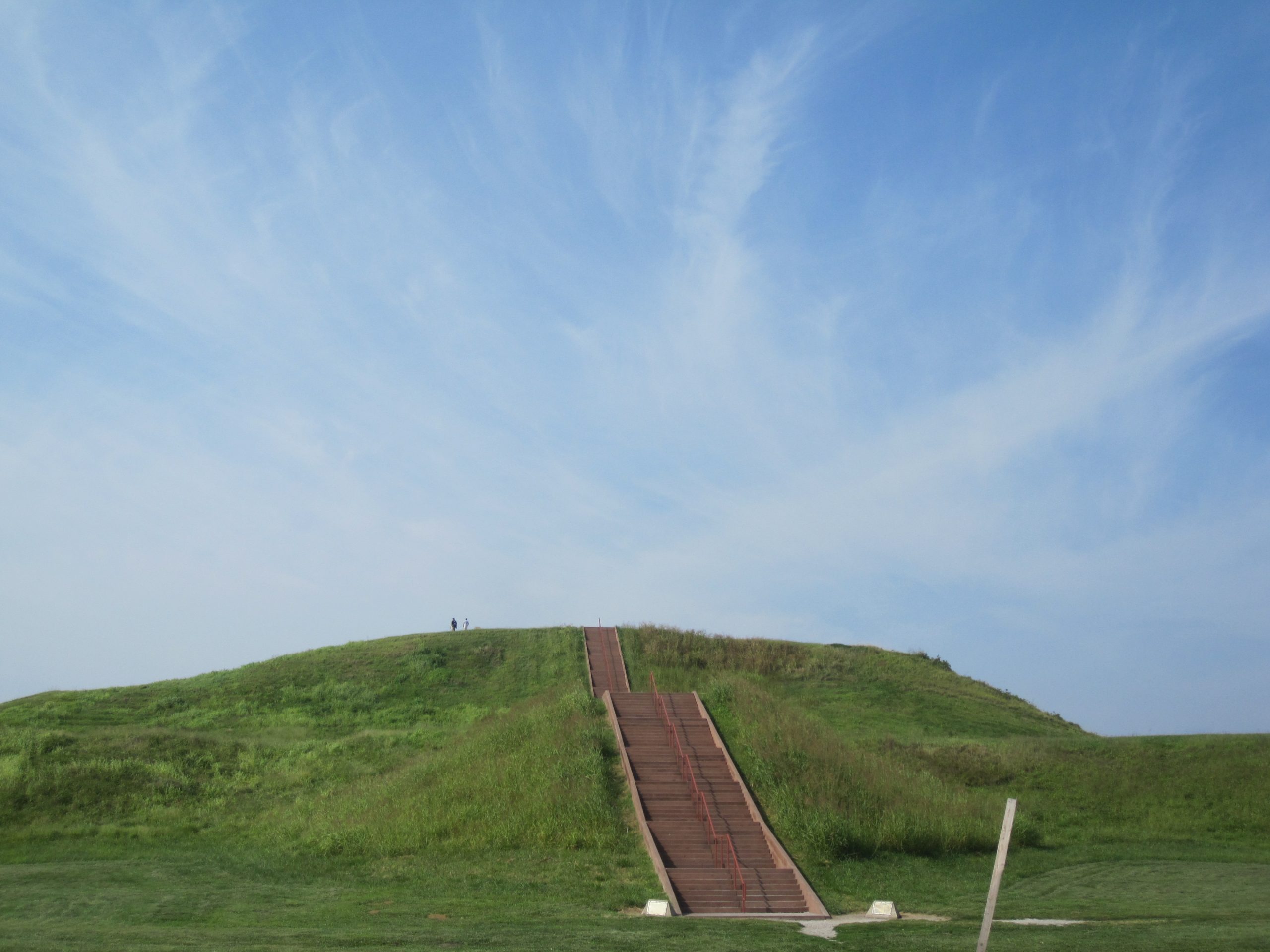
Monks Mound rises about thirty metres above the Illinois floodplain. Its broad terraces are impressive from a distance, but the scale becomes more revealing when one asks what had to happen before the mound could exist. Soil had to be selected, excavated, carried and placed. Workers needed food. Construction occupied ground that could otherwise have held houses or crops. A monument was also an arrangement of labour.
That arrangement belonged to Cahokia, the largest pre-Columbian urban centre north of Mexico. Around the eleventh and twelfth centuries, thousands of people lived near what is now Collinsville, across the Mississippi from St. Louis. Their city consisted of earthen monuments, open plazas, timber buildings, households and working landscapes. The surviving mounds are its most visible remains, not a complete inventory of what mattered there.
The National Park Service distinguishes Cahokia proper from Greater Cahokia, which includes neighbouring settlements on both sides of the river. Estimates of 10,000–20,000 residents for the central settlement and much larger regional totals refer to different areas. They should not be treated as interchangeable headcounts. No surviving census allows us to give the city’s population to the nearest person.
A city assembled in a river landscape
The American Bottom, the broad floodplain in which Cahokia developed, offered several kinds of resources within reach of one another. Fields, wetlands, streams and wooded areas supported different activities. River connections linked the region to distant communities. Water was useful for movement and food, but a floodplain was also a place where the location of a house or field mattered.
Cahokia’s great expansion around 1050 did not bring people into an untouched wilderness. Earlier communities had already farmed and reshaped this landscape. Archaeological phases describe changes in buildings, pottery and settlement patterns across generations; they are not dates recorded by the inhabitants themselves. The striking concentration of activity around 1050 is therefore better understood as a major transformation than as a precisely documented founding ceremony.
UNESCO’s account of the site emphasises the relationship between its planned centre, its agricultural base and its surviving earthworks. That combination is crucial. The monuments depended on a larger inhabited territory, while the central spaces offered places where authority could be displayed and gatherings organised. Neither the countryside nor the city can explain the other on its own.
The households behind the skyline
A photograph taken from the top of Monks Mound can make Cahokia look like a collection of isolated grass-covered hills. Much of the city has become invisible because its buildings were constructed with perishable materials. Excavators instead identify postholes, wall trenches, hearths, storage pits and changes in soil. These traces allow buildings and activity areas to be reconstructed without preserving their walls above ground.
Such evidence changes the questions historians ask. Where were houses placed relative to open spaces? Were structures rebuilt in the same location? Did storage move from shared spaces into households? These are questions about how people organised obligations and resources, rather than simply how large their monuments became.
A 2019 synthesis of Cahokia’s urban development describes both changes in residential organisation and the demands of feeding concentrated populations. Its model of political authority is an interpretation, not an excavated fact. We can establish that buildings and settlements changed more confidently than we can identify the exact commands or negotiations that caused those changes.
Food likewise requires a wider view than a field of maize. Cahokia’s inhabitants drew on a range of cultivated plants, gathered foods and animals. Plant remains from the site include small-seeded crops as well as maize. Preparing a meal could involve growing, collecting, storing, grinding, cooking and distributing food, with different tools and schedules at each stage. A crop list is evidence for ingredients, not a surviving menu for every household.
This practical relationship between monuments and provisioning also appears in Persepolis’s records of workers and rations. The comparison does not make Cahokia an American version of a Persian capital. It highlights a common historical problem: monumental buildings can survive far more clearly than the everyday work that sustained them.
People came from elsewhere
Population growth was not only a matter of births. A 2014 study of strontium isotopes in tooth enamel identified non-local signatures in about a third of the individuals examined. Enamel can preserve information about the geological environments associated with childhood food and water. Its chemistry provides a way to investigate movement when personal travel accounts do not survive.
The result concerns a studied sample, not a census of all Cahokians. Nor does a non-local signature reveal a person’s language, social identity or reason for moving. People may have arrived through marriage, kinship connections, opportunity, religious attraction or coercion. The evidence makes mobility tangible while leaving those individual circumstances largely unknown.
It also complicates any picture of Cahokia as a homogeneous community following a single inherited way of life. New arrivals could bring knowledge and relationships as well as labour. Establishing a household in an expanding settlement meant finding a place within existing networks. Archaeology can sometimes detect different practices, but it cannot automatically translate each pottery style into a distinct ethnic group.
Keeping time in public
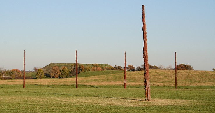
West of Monks Mound, archaeologists found the traces of large circles of wooden posts. The familiar name “Woodhenge” is modern. It identifies an arrangement with solar alignments, rather than preserving the name used by the people who built it. The circle visible today is a reconstruction based on archaeological evidence; its upright timbers are not survivors from the eleventh century.
The University of California, Berkeley’s Cahokia resource places astronomy alongside settlement, religious life and political organisation. Observing seasonal changes could help communities coordinate activities, but knowing an alignment does not tell us every ceremony performed there. The posts establish an interest in positioning and repeated observation. The words spoken around them have not survived.
A calendar used in public has different possibilities from knowledge held by an individual observer. People can gather at a shared place and recognise a recurring event. Such coordination may reinforce relationships among neighbourhoods or support the authority of specialists. At Cahokia, these are questions raised by the built setting, not a licence to invent a priest’s speech at sunrise.
The distinction matters particularly in illustrations. A reconstruction can explain an arrangement of structures more clearly than a photograph of excavated postholes. It nevertheless combines surviving evidence with decisions made by archaeologists, architects or artists. Its clarity should not be mistaken for the certainty of every detail.
A boundary made from trees
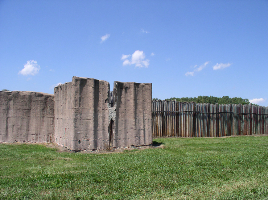
A substantial timber palisade eventually enclosed part of Cahokia’s central precinct. The reconstructed section at the historic site gives some sense of its physical presence. A wall of this kind required repeated work: selecting trees, cutting them, transporting trunks and setting posts into the ground. Replacement was part of its history, not an accidental inconvenience after construction.
The boundary also divided space. Movement into and through an enclosed centre could be channelled in ways that an open plaza could not. Defensive concerns are important to interpretations of the palisade, but enclosure could also distinguish restricted areas and make authority visible. A wall alone does not provide the name of an attacker or prove that a particular siege took place.
We should be equally cautious about calculating the political system directly from the amount of labour involved. Large collective projects require coordination. They do not by themselves tell us whether workers participated through household obligations, religious commitments, coercion, negotiated contributions or some mixture of these. The built result is clearer than the institutions behind it.
Small vessels, long connections
Some of Cahokia’s wider relationships are preserved in residues too small to see. Chemical analysis published in 2012 detected substances associated with caffeinated holly drinks in pottery beakers from Cahokia and neighbouring sites. The study connected these findings to the beverage known in later historical accounts as Black Drink.
The evidence suggests that ingredients, practices or both travelled over substantial distances. It does not permit us to copy a later documented ceremony wholesale into Cahokia’s past. A chemical signature can identify a likely preparation more securely than it can identify the precise meaning of its consumption.
That is why an ordinary-looking fragment can be historically valuable. Its shape may connect it with a class of vessels; its findspot locates it within a household or ceremonial context; its residues add another kind of information. Those forms of evidence can reinforce one another without becoming a complete transcript of an event.
Mound 72 and the limits of an old story
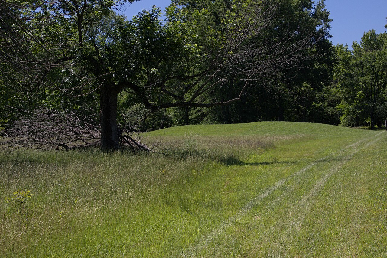
Excavations at Mound 72 revealed multiple burial episodes and stark differences in the treatment of the dead. They also produced some of Cahokia’s most influential interpretations. An elaborate burial involving shell beads was long discussed as evidence for a powerful male ruler and a strongly male-centred social order.
A reassessment reported in 2016 identified both male and female remains in the central beaded burial arrangement. This challenged the older reading. It did not establish that everyone at Cahokia enjoyed equal status, nor that every interpretation of hierarchy was mistaken. It showed how much a large argument could depend on an earlier identification.
Other burials preserve evidence of violent death. They deserve careful description rather than sensational treatment. The existence of violence does not reveal every victim’s identity, and differences in burial treatment cannot always be mapped neatly onto named ranks. The people buried here were members of human communities before they became evidence in archaeological debates.
Mound 72 therefore offers a particularly clear example of historical revision. New analysis does not merely add another object to a familiar narrative. It can change the relationship between objects, bodies and the social arrangements researchers thought they represented.
Leaving a city was a process
Cahokia’s population contracted over generations, and by about 1400 its great urban concentration had ended. Explanations have included environmental pressures, changing political relationships and conflict. The difficulty lies in connecting evidence at different scales: a regional drought, a local sediment layer and a household’s departure are not the same event.
Research reported in 2021 tested the claim that tree cutting caused erosion and local flooding sufficient to undermine the settlement. The sampled landscape did not show the expected sequence. This weakened a familiar explanation; it did not prove that Cahokians never altered forests or encountered floods.
A further study reported in 2024 used soil carbon isotopes to question a simple drought-and-crop-failure account. These investigations are valuable because they test proposed mechanisms rather than treating “collapse” as an explanation in itself. Local environmental evidence must be read alongside settlement changes, not substituted for them.
The landscape that remained
The end of metropolitan Cahokia was not the disappearance of Indigenous people from the region. Later Native communities occupied and used the area, and the site remains significant to Indigenous peoples today. Treating the grass-covered mounds as the relics of a vanished race repeats an older distortion that separated Native Americans from their own histories.
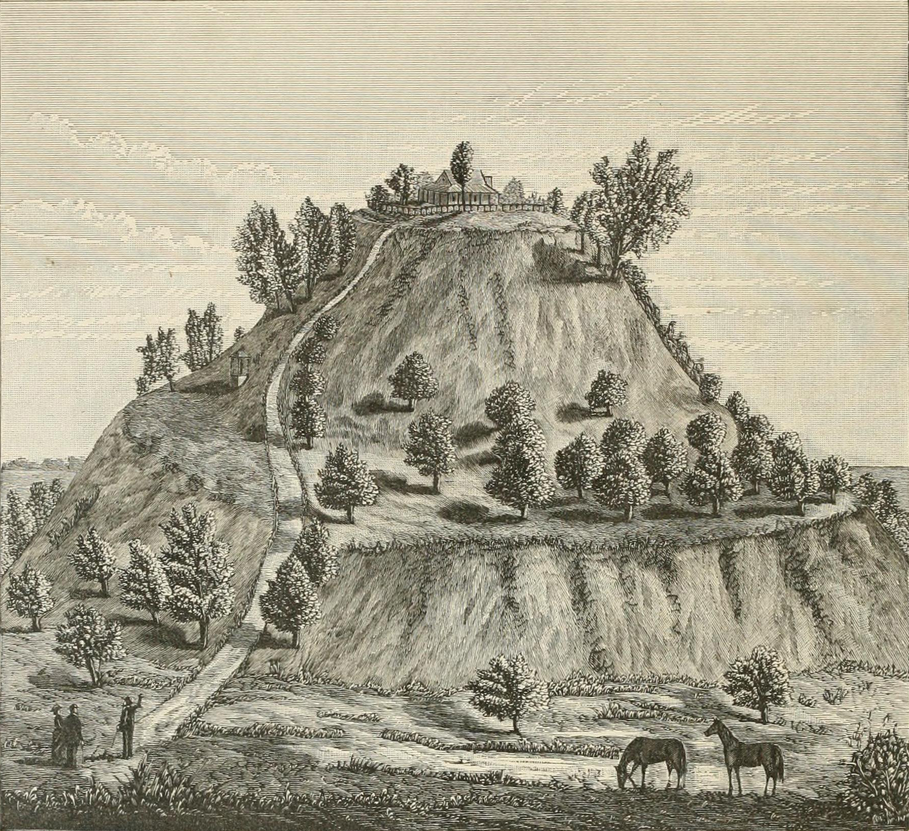
The surviving landscape has also been shaped by much later activity. Farming, roads and development damaged or removed parts of the wider mound complex. An old engraving can consequently document a stage in the site’s later life, but cannot supply an eyewitness image of the city at its height.
For a visitor, the useful starting point is to hold several scales together: the mound beneath one’s feet, the houses identified through excavation, the fields that supplied residents and the routes by which people arrived. Cahokia becomes more comprehensible when those parts are restored to the same history. The great earthworks remain extraordinary, but they were built within a living city.